
Saba’s nature: take a look at its hiking trails
Saba’s hiking Trails offer a nice view of Saba’s flora and unique beauty. Some pass old ruins, some delve into caves, some go around the uninhabited side of the island, some go through the rainforest, and all offer something different. Most trails are very well-marked and in good condition.
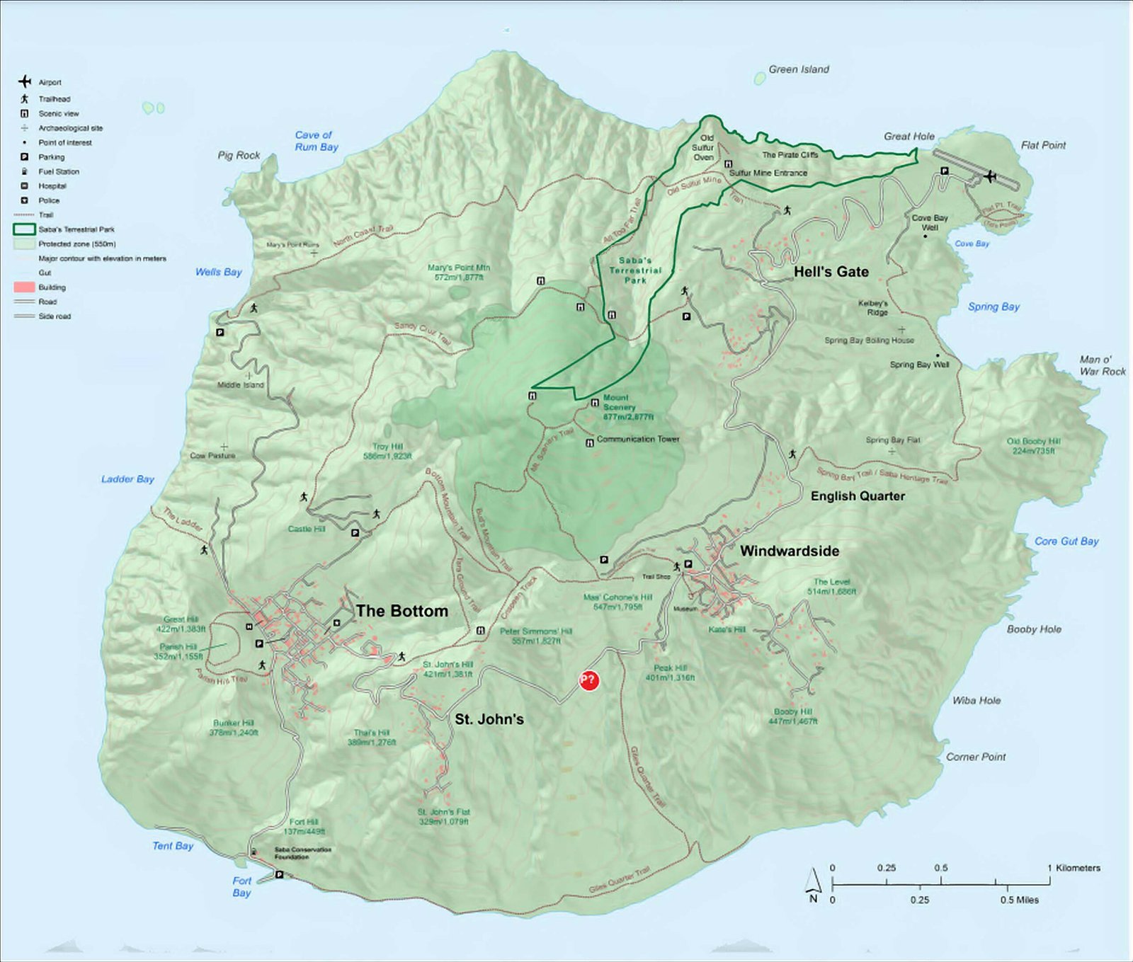
Click here to download a printable version of the map (340 kB)
The green lines connect the points of the same elevation. You may use this information to estimate the amount that you have to climb or descend on the trail.
The Saba Tourist Bureau provides detailed information on the trails: HERE.
They also provide information on the status of the trails HERE.
You can also check out the information at the Sabapark site HERE
There is also a rather old topgraphic map of Saba that you could consult for detailed planning of your hiking trips. Click here to download the topographic map (10MB). The roads and buildings have been extended, but the hills remain the same. Enjoy.
